- Steven Erlanger, International Herald Tribune. Friday, August 10, 2007
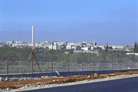
- Photo: Apartheid Roads outside of Qalqilyah, Palestine.
JERUSALEM: Israel is constructing a road through the West Bank, east of Jerusalem, that will allow both Israelis and Palestinians to travel along it – separately.
There are two pairs of lanes, one for each tribe, separated by a tall wall of concrete patterned to look like Jerusalem stone, an effort at beautification, indicating that the road is meant to be permanent. The Israeli side has various exits. The Palestinian side has few.
The point of the road, according to those who planned it under the previous prime minister, Ariel Sharon, is to permit Israel to build more settlements around east Jerusalem, cutting the city off from the West Bank but allowing Palestinians to travel unimpeded north and south through Israeli-held land.
“The Americans demanded from Sharon contiguity for a Palestinian state,” said Shaul Arieli, a reserve colonel in the Israeli Army who participated in the 2000 Camp David negotiations and specializes in maps.
“This road was Sharon’s answer, to build a road for Palestinians between Ramallah and Bethlehem but not to Jerusalem,” Arieli said. “This was how to connect the West Bank while keeping Jerusalem united and not giving Palestinians any blanket permission to enter east Jerusalem.”
Sharon talked of “transportational contiguity” for Palestinians in a future Palestinian state, meaning that although Israeli settlements would jut into the area, Palestinian cars on the road would pass unimpeded through Israeli-controlled territory and even cross through areas enclosed by the Israeli separation barrier.
The vast majority of Palestinians, unlike Israeli settlers, will not be able to exit in areas surrounded by the barrier or enter Jerusalem, even the eastern part, which Israel seized in 1967.
The road bars such stops by having Palestinian traffic continue through underpasses and over bridges, while Israeli traffic will have interchanges allowing turns onto access roads. Palestinians with Israeli identity cards or special permits for Jerusalem will be able to use the Israeli side of the road.
The government of Prime Minister Ehud Olmert has recently made conciliatory gestures to the Palestinians and says it wants to facilitate the creation of a Palestinian state. But Olmert, like Sharon, has said that Israel intends to keep the land east of Jerusalem.
To Daniel Seidemann, a lawyer who advises Ir Amim, an Israeli advocacy group that works for Israeli-Palestinian cooperation in Jerusalem, the road suggests an ominous map of the future, in which Israel keeps nearly all of east Jerusalem and a ring of Israeli settlements surrounding it, between largely Arab east Jerusalem and the rest of the West Bank, which would become part of a future Palestinian state.
In a final settlement, Israel is expected to offer the Palestinians land swaps elsewhere to compensate.
The road will allow Israeli settlers living in the northern West Bank, near Ramallah, to move quickly into Jerusalem, protected from the Palestinians who surround them. It also helps ensure that Maale Adumim, a suburban settlement of 32,000 east of Jerusalem, where most of its residents work, will remain under Israeli control, along with an empty area designated E1, between Maale Adumim and Jerusalem, that Israel also intends to keep.
For the Palestinians, the road will connect the northern and southern parts of the West Bank. In a future that may have fewer checkpoints, they could travel directly from Ramallah north of Jerusalem to Bethlehem south of it, while being forced to bypass Maale Adumim and Jerusalem.
“To me, this road is a move to create borders, to change final status,” Seidemann said. “It’s to allow Maale Adumim and E1 into Jerusalem but be able to say, ‘See, we’re treating the Palestinians well – there’s geographical contiguity.’ ”
Measure it yourself, he said. “The Palestinian road is 16 meters wide. The Israeli theory of a contiguous Palestinian state is 16 meters wide.”
Khalil Tufakji, a top Palestinian geographer, said the road “is part of Sharon’s plan: two states in one state, so the Israelis and the Palestinians each have their own roads.” The Palestinians, Tufakji said, “will have no connection with the Israelis, but travel through tunnels and over bridges, while the Israelis will travel through Palestinian land without seeing an Arab.”
In the end, he said, “there is no Palestinian state, even though the Israelis speak of one.” Instead, he said, “there will be a settler state and a Palestinian built-up area, divided into three sectors, cut by fingers of Israeli settlement and connected only by narrow roads.”
Asked for comment, David Baker, an Israeli government spokesman, said: “The security arrangements on these roads are in place to protect the citizens of Israel. And they are not connected to any other matter.”
Micaela Schweitzer-Bluhm, spokeswoman for the U.S. Consulate in Jerusalem, cited the Bush administration’s policy that Palestinians should be allowed to travel more easily through the West Bank “consistent with the need to maintain security.”
Asked if this road predetermines final status, she said: “The U.S. government has encouraged the parties to avoid any actions that would predetermine permanent status,” but said she was not authorized to comment more specifically.
Tufakji says he has become cynical about the way Israel builds for the future it defines, no matter what it promises Washington. He sees a West Bank divided into three parts by Israeli settlement blocs, the most important of which is Maale Adumim and E1, around the capital that both peoples claim.
“Israel is building the infrastructure to keep E1, to surround Jerusalem,” he said. “They are working to have an area of minimum Palestinians and maximum Israelis.”


